
Planet Earth as Art Presentation References
In the course of my presentation Planet Earth as Art: The View from Space I make reference to a number of online resources and use a number of geological terms.
Presented here is a list of those resources as well as links to websites with relevant geology information to supplement the information provided in the lecture.
Online Image Targeting Research
Following are the tools that I use in searching the Earth for areas of visual interest.
- Google Earth browser version (note that I do not use the browser version but it’s there)
- Google Earth Pro desktop software (recommended)
- Zoom Earth
- USGS Earthexplorer
- Earth Snapshot
- ESA (European Space Agency) Space in Images Observing the Earth
- ESA Earth Observation Image of the Week
- NASA Earth Observatory
- NASA Landsat Visible Earth Image Gallery
Sources of Remote Sensing Data and Related Technical Information
Following are the data sources and data-related sources of information that I use in acquiring remote sensing imagery.
- USGS (U.S. Geological Survey) Earthexplorer
- Copernicus Open Access Hub for access to Sentinel-1, Sentinel-2, Sentinel-3 and Sentinel-5P data.
- USGS Landsat Data Tools information
- ESA (European Space Agency) DATA ACCESS INFO
- NASA Earth Data
- Vertex Alaska Satellite Facility’s data portal for remotely sensed imagery of the Earth.
- Landsat Science – Landsat 8 Bands
Software Used
In the course of processing the imaging data from remote sensing satellites, primarily Landsat, I use a variety of software tools.
For workflow automation I use the following:
- G’MIC (GREYC’s Magic for Image Computing) image processing language
- Python programming language
- Processing programming language
- MS DOS BAT files
For individualized image processing I make use of the following software tools:
Geological Feature Identification
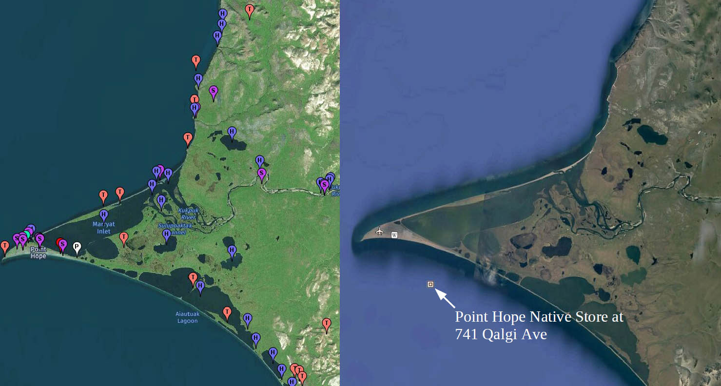
Unfortunately Google Earth does a horrible job at naming geological/geographic features. For example, following is a screen shot of Hope Point Alaska as viewed in Geonames (left) and Google Earth (right). Geonames clearly provides far more naming information than Google Earth making Geonames the uncontested winnner.
- GeoNames geographical database (an indispensible resource)
- Geographical Names data source being the National Geospatial Intelligence Agency
- Australian Antarctic Data Centre Antarctic place names
Information about Geology
Following are links to useful references on geology.
- Landforms on Wikipedia – an excellent reference and index page
- Geomorphology on Wikipedia
- Major Types of Dunes: Where and How They Form
- Deserts and desert processes
- Glaciers
- What is river and stream erosion?