Planet Earth Satellite Imagery and Art on Redbubble

The Planet Earth Satellite Imagery Photo Gallery is a collection of satellite images, and artistic interpretations of satellite images, of Earth I have hosted on Redbubble. All images have been subject to varying degrees of image processing. Enjoy the beauty of our home world.

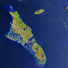
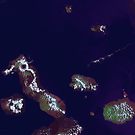
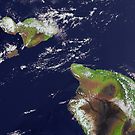
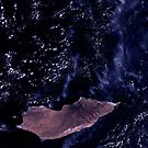
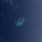
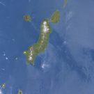
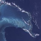
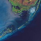
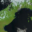
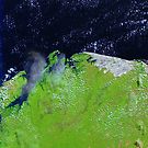
Islands of the World

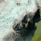
The images in this collection feature islands as their subject. Islands include Andros Island (Bahamas), the Galapagos Islands (Ecuador), the Faroe Islands (Denmark), Catalina and San Clemente Islands (United States), Bikini Atoll (Marshall Islands), Vulkan Ekarma (Russia), the Florida Keys (United States), Dirk Hartog Island (Australia), Hawaii, Maui, and Kahoolawe Islands (United States), Tortuga Island (Venezuela), Socotra Island (Yemen), Bermuda (United Kingdom), Cape Verde Islands and the Kuril Islands (Russia).


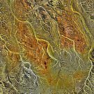
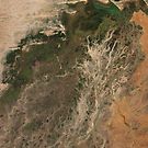
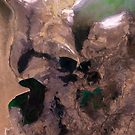
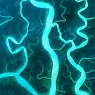
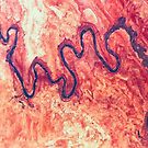
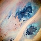
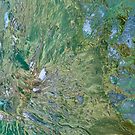
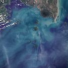
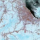
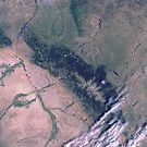
Rivers, River Deltas, and other Waterways

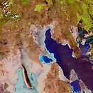
Rivers, deltas, and bodies of water present as of February 2019 include theVolga River, Niger River, Amu Darya River, the South Aral Sea, Sundarbans National Park, San Juan River, Panama Canal, Chinle Creek, Gulf of Mexico, and Great Salt Lake
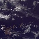
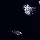
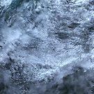
Volga River Delta Russia False Color Satellite Image by Jim Plaxco Niger River Inland Delta Mali False Color Satellite Image by Jim PlaxcoNiger River Inland Delta Mali Africa Satellite Image by Jim PlaxcoAmu Darya River Delta and South Aral Sea Satellite Image by Jim PlaxcoSundarbans National Park Mangrove Forest by Jim PlaxcoSan Juan River Tributary Utah Aerial Landscape by Jim PlaxcoSatellite Image Panama Canal Central America by Jim PlaxcoSan Juan River and Chinle Creek Utah Satellite Image by Jim PlaxcoFlowing Waters Gulf of Mexico by Jim PlaxcoSatellite Image Panama Canal Central America by Jim PlaxcoGreat Salt Lake Utah Satellite Image by Jim Plaxco
 

Clouds

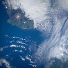
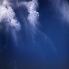
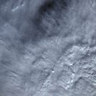
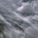
The images in this collection have atmospheric phenomena as their central feature.
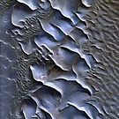
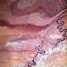
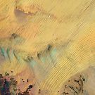
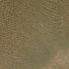
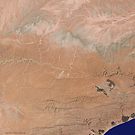
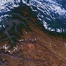
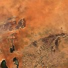
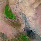
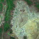
Clouds Over Turks and Caicos Islands Satellite Image by Jim PlaxcoClouds Over the Gulf of California, Mexico Satellite Image  by Jim PlaxcoAbstract Clouds Over Ocean Satellite Image by Jim PlaxcoRussian Arctic Clouds and Ice Satellite Image by Jim PlaxcoClouds Over Rub al Khali Desert Saudia Arabia Satellite Image by Jim PlaxcoCanadian Pacific Ocean Clouds Satellite Image by Jim PlaxcoGlacier Bay National Park Clouds Alaska Satellite Image by Jim PlaxcoGreenland Ice Sheet and Clouds Satellite Photograph by Jim Plaxco
 

Deserts

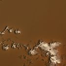
Deserts and dune fields shown in this collection are drawn from the desert regions of Saudi Arabia, Libya, and Yemen.

Saudi Arabia Rub al Khali Desert Sand Sea by Jim PlaxcoFalse Color Desert Sand Dunes in Saudi Arabia Satellite Image by Jim PlaxcoSand Dunes in Rub al Khali Desert Saudi Arabia Satellite Image by Jim PlaxcoClouds Over Rub al Khali Desert Saudia Arabia Satellite Image by Jim PlaxcoJebel Uweinat Jabal Arkanu in Sand Sea Libya Satellite Image by Jim PlaxcoSatellite image Southeast Yemen by Jim Plaxco
 

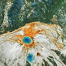
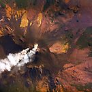
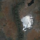
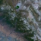
Mountains and Volcanoes

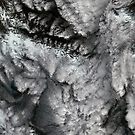
The mountains and volcanoes collection of satellite images includes Mount Etna, the San Miguel Volcano, Mount St Helens, Anak Krakatau (Krakatoa), Mount Everest, Vulkan Ekarma, and the Kuril Island chain of volcanic islands.

Mount Etna Volcanic Eruption Sicily Italy Space Image by Jim PlaxcoSan Miguel Volcano El Salvador Satellite Image by Jim PlaxcoMount St Helens Volcano Washington False Color Image by Jim PlaxcoAnak Krakatau aka Krakatoa Volcano by Jim PlaxcoMount Everest Nepal Satellite Image by Jim PlaxcoVulkan Ekarma Volcanic Island Satellite Image by Jim PlaxcoKuril Island Chain Volcanic Islands Satellite Image by Jim Plaxco
 

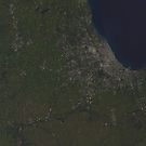
Cities and Civilizations

Images in this collection feature the works of man including the cities of Chicago, Casablanca, Machu Picchu, and Timbuktu. Also included is Spaceport America.

Chicago Illinois Winter Satellite Image by Jim PlaxcoCasablanca Mohammedia Morocco Satellite Image by Jim PlaxcoMachu Picchu and the Andes Mountains of Peru Satellite Image by Jim PlaxcoTimbuktu Niger River Mali Satellite Image by Jim PlaxcoSpaceport America and White Sands New Mexico Satellite Image by Jim PlaxcoSatellite Image of Chicago Illinois by Jim Plaxco
 

National Parks and Preserves

Images in this collection include Grand Canyon National Park (United States), Lencois Maranhenses National Park (Brazil), Bighorn National Forest (United States), Yosemite National Park (United States), Capitol Reef Canyonlands National Park (United States), Everglades National (United States), and Sundarbans National Park (Bangladesh).
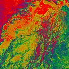
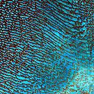
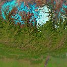
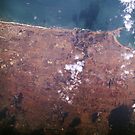
Satellite Image Grand Canyon National Park Arizona by Jim PlaxcoBrazil Lencois Maranhenses National Park Sao Marcos Bay Satellite Image by Jim Plaxco Bighorn National Forest Wyoming Satellite Image by Jim PlaxcoYosemite National Park and Sierra Nevada Mountains California Satellite Image by Jim PlaxcoCapitol Reef Canyonlands National Parks Utah Satellite Image by Jim PlaxcoSundarbans National Park Mangrove Forest by Jim PlaxcoSatellite Image Everglades National Park and Florida Keys by Jim Plaxco
 

False Color Images

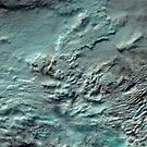
The following are false color images. As false color images, non-RGB color channels were used in their creation.

Volga River Delta Russia False Color Satellite Image by Jim Plaxco Niger River Inland Delta Mali False Color Satellite Image by Jim PlaxcoFalse Color Desert Sand Dunes in Saudi Arabia Satellite Image by Jim PlaxcoMount St Helens Volcano Washington False Color Image by Jim Plaxco
 

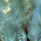
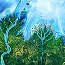
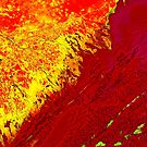
Artistic Interpretations of Earth

This is a collection of art that was inspired by satellite images of the Earth. The only exception in this collection is that of the Grand Prismatic Hot Spring of Yellowstone National Park which is based on an aerial photograph.

San Juan River Tributary Utah Aerial Landscape  by Jim PlaxcoGrand Prismatic Hot Spring Yellowstone National Park by Jim PlaxcoDesert Sand Dunes by Moonlight by Jim PlaxcoAerial Anatomy of a Desert Landscape by Jim PlaxcoClouds on Water Natural Abstract by Jim PlaxcoFlowing Waters Gulf of Mexico by Jim Plaxco
 

Earth as Art Related Pages


Pin It on Pinterest

Share This